Antelope-Valley
Maps

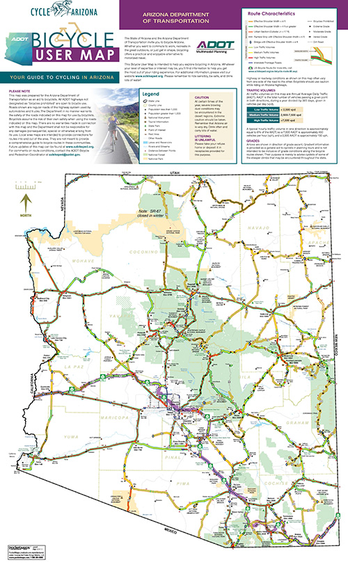
Arizona State Highway Bicycle User Map

Arizona State Highway Bicycle Interactive Map

Arizona State Highway Pedestrian Interactive Map

U.S. Bicycle Route 90

The American Association of State Highway and Transportation Officials (AASHTO), Special Committee on U.S. Route Numbering, approved the application submitted by the Arizona Department of Transportation to establish U.S. Bicycle Route 90.

The east-west Route is 573 miles long and runs along existing state highways, local streets, and shared-use paths. U.S. Bicycle Route 90 connects the State border of New Mexico and the State border of California.

U.S. Bicycle Route 90 Map

Turn-By-Turn Directions

U.S. Bicycle Route System Interactive Map


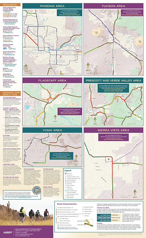
Local Area Bicycle and Pedestrian Maps


Phoenix Metro Area Bikeways

Ajo Mountain Bike Trails

Glendale Bike Map

Mesa Bike Map

McDowell Sonoran Preserves

Phoenix Sonoran Bikeway

Pima Bikeways Map

Prescott Trails and Outdoor Recreation Map

Scottsdale Bikeways Map

Sierra Vista Bicycle & Multi-Use Path Map

Stoneman Lake (near Sedona)

Tempe Bike Map

Verde Valley

Flagstaff Urban Trails and Bikeways Map

Santa Cruz Valley Bike Map

Yuma Bikeways Map